
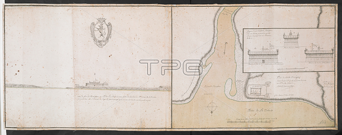
鈥楶lan de fort de Chou茅ghen'; signed Norbert Lamorendiere; but clearly by Paul Labrosse; aft. 1727. There is also a perspective view of the fort. 1: 700 approx. 鈥楨chelle de 50 toises' (= 142mm.). Inset; elevations of the fort.: 1: 200 approx.; 鈥楨chelle de 60 pieds' (= 93mm.). Map oriented with South at top.405 x 550mm. view 405 x 1115mm.18th century. After 1727.From: R.U.S.I. MAPS. Vol. LXXIII (1-13).Add. 57708 f. 2 Amherst no. A 64. R.U.S.I. no. A 30.38. London; British Library.
| px | px | dpi | = | cm | x | cm | = | MB |
Details
Creative#:
TOP20498566
Source:
達志影像
Authorization Type:
RM
Release Information:
須由TPG 完整授權
Model Release:
No
Property Release:
No
Right to Privacy:
No
Same folder images:
Restriction:
Additional permissions needed for non-editorial use.
 Loading