
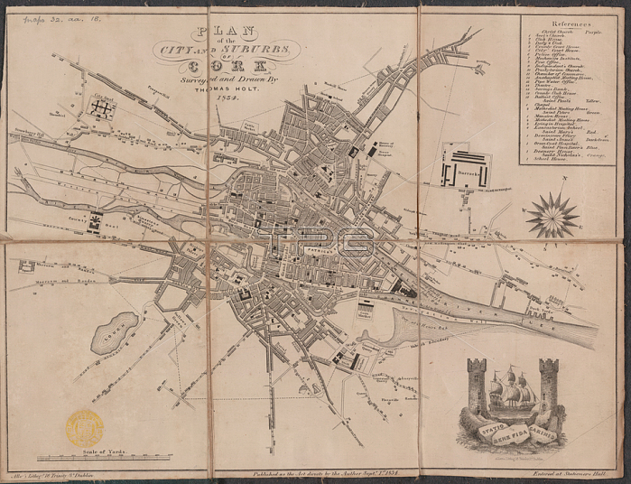
A plan of the city and suburbs of Cork.Dublin; 1834.From: Plan of the City and Suburbs of Cork; surveyed and drawn by Thomas Holt. Scale of yards; 1; 000[ = 61 mm].Maps 32. aa. 18London; British Library.
| px | px | dpi | = | cm | x | cm | = | MB |
Details
Creative#:
TOP20503632
Source:
達志影像
Authorization Type:
RM
Release Information:
須由TPG 完整授權
Model Release:
No
Property Release:
No
Right to Privacy:
No
Same folder images:
Restriction:
Additional permissions needed for non-editorial use.
 Loading