
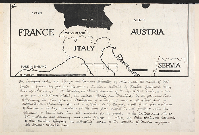
A map of the First World War; showing France; Switzerland; Italy; Austria and Serbia. 345 x 365 mm.[London]: S[p]ecially prepared for the Toy Target Company; 1914.From: Knock out Germany. An instructive partial map of Europe with Germany silhouetted; etc.Maps. 1078. (41)London; British Library.
| px | px | dpi | = | cm | x | cm | = | MB |
Details
Creative#:
TOP20997049
Source:
達志影像
Authorization Type:
RM
Release Information:
須由TPG 完整授權
Model Release:
No
Property Release:
No
Right to Privacy:
No
Same folder images:
Restriction:
Additional permissions needed for non-editorial use.
 Loading