
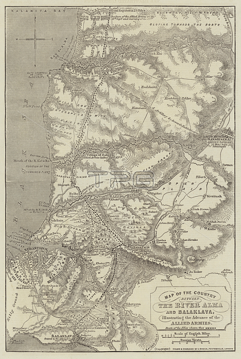
1601919 Map of the Country between the River Alma and Balaklava, illustrating the Advance of the Allied Armies (engraving) by Dower, John (fl.c.1845-55); Private Collection; (add.info.: Map of the Country between the River Alma and Balaklava, illustrating the Advance of the Allied Armies. Illustration for The Illustrated London News, 20 January 1855. J Dower); Look and Learn / Illustrated Papers Collection.
| px | px | dpi | = | cm | x | cm | = | MB |
Details
Creative#:
TOP27395224
Source:
達志影像
Authorization Type:
RM
Release Information:
須由TPG 完整授權
Model Release:
No
Property Release:
No
Right to Privacy:
No
Same folder images:
 Loading