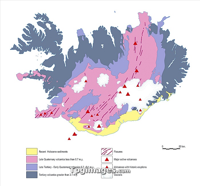
Geological map of Iceland. Map of Iceland showing a number of geological features including volcanoes, glaciers and eruptive fissures. Iceland lies on the Mid-Atlantic Ridge, the spreading boundary between the North American and Eurasian plates, and has been formed by successive eruptions of volcanic rock. The map is colour-coded according to when the volcanic rock was laid down.
| px | px | dpi | = | cm | x | cm | = | MB |
Details
Creative#:
TOP06665445
Source:
達志影像
Authorization Type:
RM
Release Information:
須由TPG 完整授權
Model Release:
NO
Property Release:
NO
Right to Privacy:
No
Same folder images:
icelandcountrymapeuropegeographygeologyphysicalgeographyartworkdiagramactivebasalticboundarycutoutcutoutscut-outcut-outscutoutcutoutsdivergentdivergingplateseruptivefissureeurasianplateeuropeanfissuresformationgeographicalgeologicriftgeologicalglacierglaciershotspoticelandicplumeillustrationislandkeylavavolcanicmarmidatlanticmid-atlanticridgenorthamericanplateplatetectonicsrockspreadingtextvolcanicvolcanovolcanoeswhitebackground"
"activeamericanartworkatlanticbackgroundbasalticboundarycountrycutcutcut-outcut-outscutoutcutoutsdiagramdivergentdivergingeruptiveeurasianeuropeeuropeanfissurefissuresformationgeographicalgeographygeographygeologicgeologicalgeologyglacierglaciershotspoticelandicelandicillustrationislandkeylavamapmarmidmid-atlanticnorthoutoutsphysicalplateplateplateplatesplumeridgeriftrockspreadingtectonicstextvolcanicvolcanicvolcanovolcanoeswhite

 Loading