
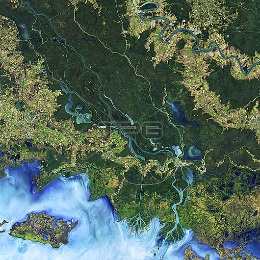
Satellite image capturing the influence of winds on pond growth in the Atchafalaya Basin in Louisiana, USA. A study published in 2017 highlights that winds are a significant factor in the extensive development of ponds in three watersheds along the Mississippi River. The research suggests that wind-driven waves can erode the banks of ponds, causing them to shift in the direction of the wind. This study reveals that wind-driven erosion, which typically affects coastlines and the edges of larger bodies of water, can also occur on a smaller scale inland. Image acquired with the Operational Land Imager (OLI) sensor on the Landsat 8 satellite, on 1 December 2016.
| px | px | dpi | = | cm | x | cm | = | MB |
Details
Creative#:
TOP30165148
Source:
達志影像
Authorization Type:
RM
Release Information:
須由TPG 完整授權
Model Release:
N/A
Property Release:
N/A
Right to Privacy:
No
Same folder images:
 Loading